Model Evaluation
The importance of model validation, calibration and error analysis is an undiscussed subject of any modeling process. The aim of this project is to quantify the uncertainties, and to validate and calibrate physically-based permafrost models in high-alpine environements. Model errors and uncertainties arise from unknown parameters, errors in the input measurements, or numerical discretizations (Figure 1). Model behaviour and model errors/uncertainties are likely to vary strongly in the topographically variable terrain. Model validation hence requires sampling of spatially-distribution data that represent the main environmental features that may influence model outputs such as the topographic attributes elevation, slope and aspect as well as the ground cover type. Spatially-distributed data allow to quantify model errors systematically. Similarly, model sensitivities and uncertainties should be determined systematically at location covering the range of environmental variability encountered in the modeling domain (Fig. 2 to Fig. 5).
Project
- Spatially-distributed ground surface temperatures (GST) measured using iButtons: GST were sampled at 39 locations around Corvatsch mountain, Engadine, Switzerland, covering elevations from 1900 to 3300m asl, shallow to steep slopes, all expositions from North to South and different ground cover types. The data allowed quantification of the environmental influence on the mean annual GST (MAGST), the melt-out day of snow and the snow ripening date, and serves to validate spatially-distributed mountain permafrost models. At each location, the random replication of 10 measurement devices serves to quantify the environmental variability of GST within 10m x 10m, representing the small scale variability of a quantity of interest within a grid cell of a digital elevation model typically used in mountain permafrost model.
- Quantification of uncertainties of the modeled clear-sky downward shortwave radiation (SDR) and calibration of paramterized all-sky downward longwave radiation (LDR): SDR and LDR are important input fluxes in any permafrost model. Eleven all-sky LDR models were calibrated using high-quality measurements from the Alpine Surface Radiation Budget network (ASRB) by MeteoSwiss, and the uncertainties of a clear-sky SDR model and one of the all-sky LDR parameterizations were quantified at six locations in Switzerland.
- The model GEOtop (www.geotop.org) is a physically-based energy- and mass balance model used for permafrost modeling. Errors arising from numerical discretization parameters were quantified (Fig. 6), and the sensitivities and parametric uncertainties of GEOtop are quantified within an artificial environment at altitudes from 500 to 4000m asl, all aspects, slopes up to 30 degrees and six different ground types (Fig. 7). That setting allows quantification of the influence of the environment on model uncertainties, and showed that model behaviour is strongly variable under differing environmental conditions. A next step in the model evaluation process would be validation with GST or rock temperature measurements.
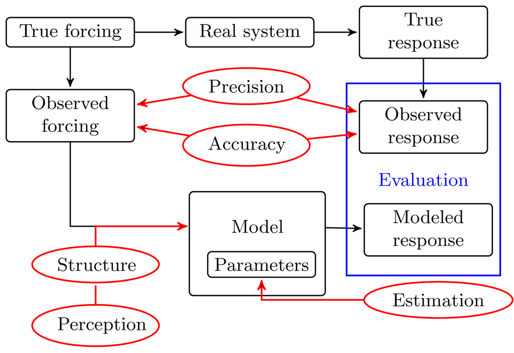
- Figure 1) Sources of uncertainty

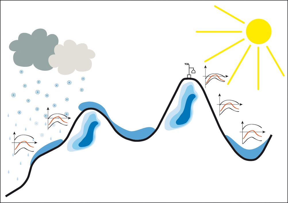
- Figure 2) Model evaluation at one location
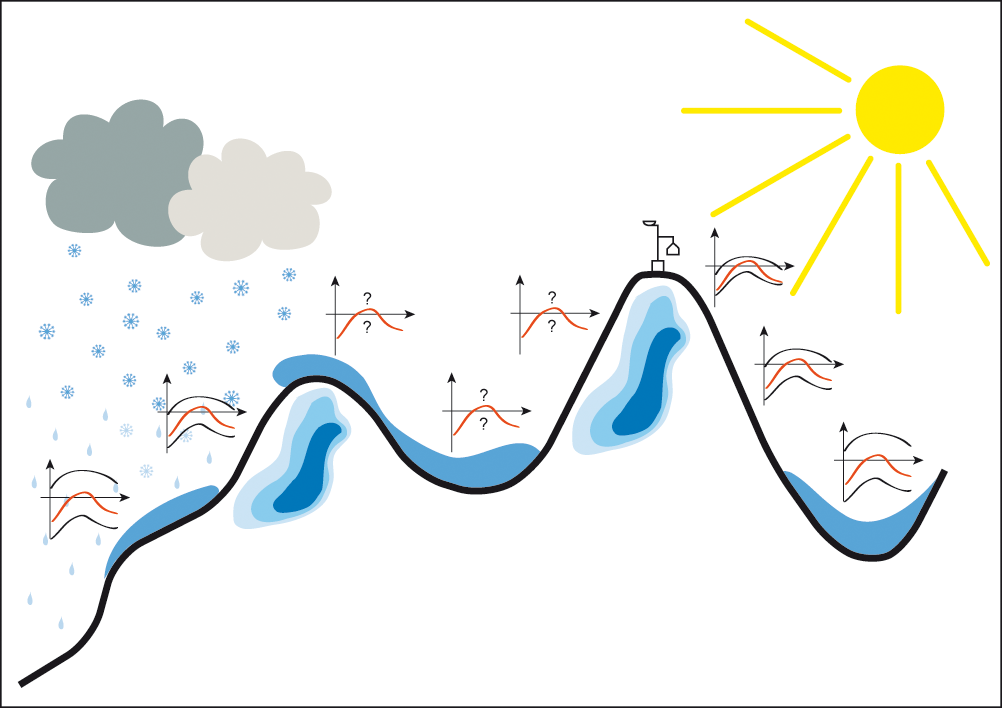
- Figure 3) Spatial uncertainty estimation using Monte Carlo methods
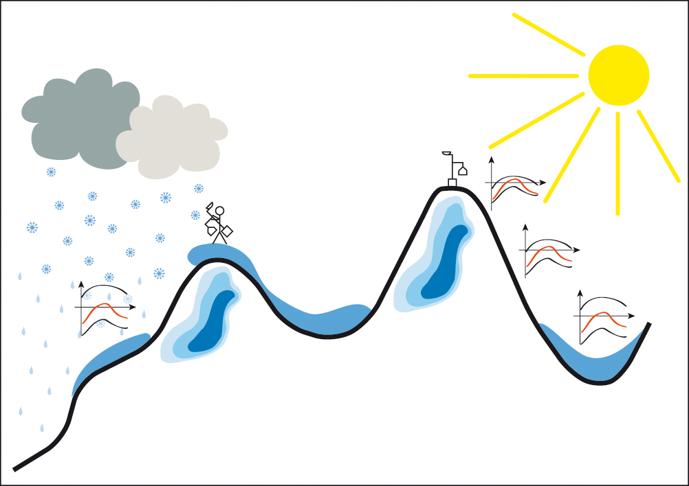
- Figure 4) Statistical uncertainty modeling
- Figure 5) Optimized combination of measurements with models
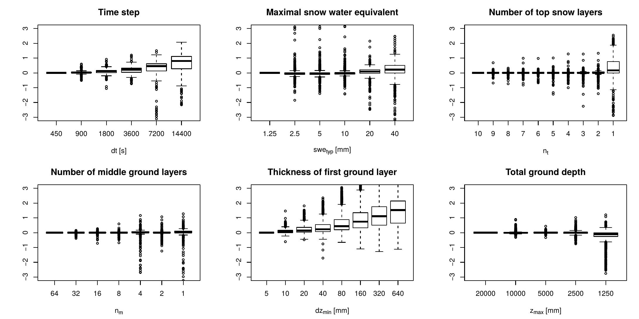
- 6) Model errors due to numerical discretization
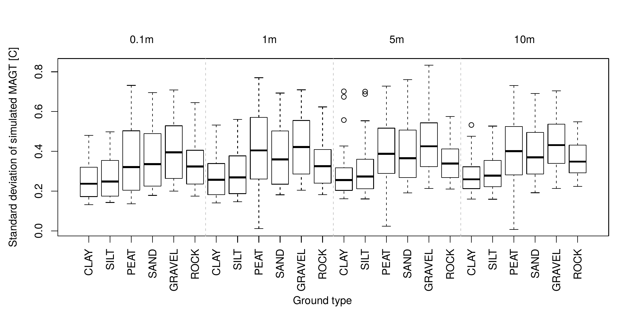
- Fig 7) Total parametric output uncertainty of modeled GTs at different depth, and for six different soil types.